Imposition of Order
![]()
Click on anchor points to view corresponding panel and title. You can move the map around by clicking and dragging. View a larger version of the map by clicking on the [ ] brackets on the top right of the map.
![]()
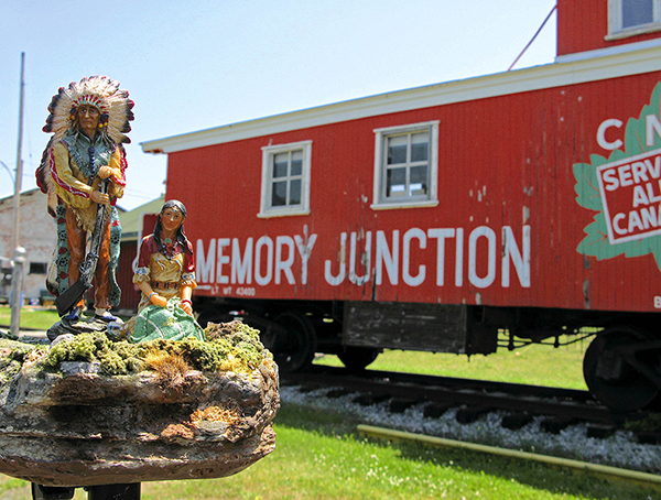
1. Imposition of Order (2017) pigment print on archival paper
KEY TO IMAGES (left to right)
Samuel de Champlain, Geographical map of the New Franse made by the Sieur de Champlain Saint Tongois Ordinary Cappitaine for the King in the Navy. Faict len 1612. Courtesy: Library and Archives Canada, e010764733 This map, engraved in 1612, was published in Samuel de Champlain’s Les voyages de 1613 (attached at the end of the volume, see Amicus 4700723). It represents the territory explored by Champlain up to 1611 as well as information he had gleaned from Amerindians and other European explorers and cartographers.
Jeff Thomas, Samuel de Champlain Monument (1992) Ottawa, Ontario, GPS: 45.4294 -75.70145
William Berczy the Elder. Portrait of Joseph Brant (c. 1808) Oil on canvas, 38.5 x 35.5 cm. The Thomson Collection at the Art Gallery of Ontario, Toronto
Plan shewing the Lands granted to The Six Nations Indians situated on each side of the Grand River or Ouse; commencing on Lake Erie and containing about 674,910 acres. Copy J.G. C. [with an extract from the Deed of Feoffment], 7th December 1792. Courtesy of Library and Archives Canada/ H3/410/Grand/1792
![]()
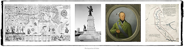
2. Some Things Never Change (1996/2016) pigment print on archival paper
KEY TO IMAGES (left to right):
Jeff Thomas, Joseph Tehwehron David (1957–2004) (1997) Mohawk, artist, and veteran of the 1990 Oka Crisis
John Verelst, John of Canajoharie (1710) courtesy Library Archives Canada/C-092417, LAC, Ottawa, Ontario, GPS: 45.42005 -75.70789
Jeff Thomas, Bear Thomas (Cayuga) (1996) Samuel de Champlain Monument, Ottawa, Ontario, GPS: 45.4294 -75.70145
![]()
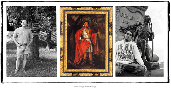
3. Who Was Thomas Moore? (2012) pigment print on archival paper, 20″ x 25″
KEY TO IMAGES (left to right):
Unknown photographer, Annual Report of the Department of Indian Affairs, 1896 (1897), Courtesy of Library Archives Canada/ C-022474, GPS: 50.760383 -104.199583
![]()
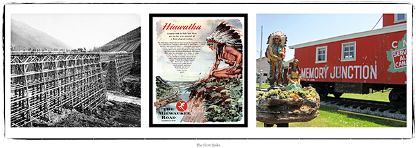
4. The First Spike (2017) pigment print on archival paper
KEY TO IMAGES (left to right):
Norman Denley, Canadian Pacific Railway bridge, Mountain Creek, British Columbia, ca. 1880-1890, Courtesy Library Archives Canada/PA-066576
Milwaukee Railroad “Hiawatha” Advertisement Poster
Jeff Thomas, Father and Daughter (2006) Memory Junction Museum, Brighton, Ontario, GPS: 44.036183 -77.7429
![]()
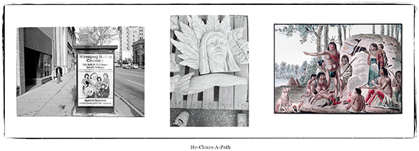
5. He-Clears-A-Path (2013) pigment print on archival paper, 20″ x 47″
KEY TO IMAGES (left to right):
Jeff Thomas, Antone Family, Bus Shelter Poster (1990) Main Street, Winnipeg, Manitoba, GPS: 49.89724 -97.1391
Jeff Thomas, Indian Head (1990) Portage Avenue and Notre Dame Ave, Winnipeg, Manitoba, GPS: 49.89521 -97.13975
Peter Rindisbacher, A family from the tribe of the wild Sautaux Indians on the Red River (ca. 1821) Courtesy: Peter Rindisbacher/ Library and Archives Canada, Acc. No. 1988-250- 28. Approximate GPS: 49.88528 -97.12907
![]()
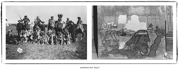
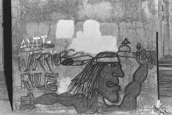
6. WARRIORS RULE (2015) pigment print on archival paper, 46” x 39”
KEY TO IMAGES (left to right)
Geraldine Moodie, Sun Dance gathering, Cree men (June 1895) Battleford, Battleford Saskatchewan area. Geraldine Moodie/ Library and Archives Canada/ PA-028833, GPS: 45.42005 -75.70789
Jeff Thomas, Graffito, Mercier Bridge Pier (1994) Kahnawake Reserve, Québec, GPS: 45.40863 -73.65925
![]()
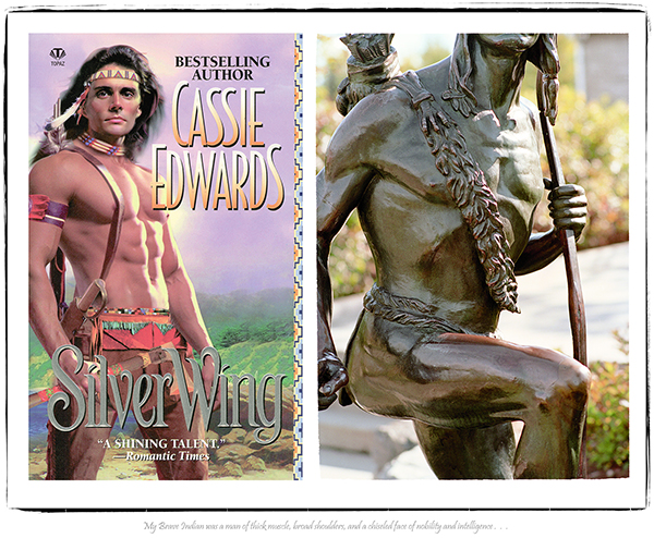
7. My Brave Indian (2008) pigment print on archival paper, 30” x 59”
KEY TO IMAGES (left to right)
Silver Wing, Romance Novelist Cassie Edwards (2002) Chapters Bookstore, Ottawa, Ontario, GPS: 45.42584 -75.69305
Jeff Thomas, “No Retreat” (Indian Scout), (2002) Major’s Hill Park (Reserve), Ottawa, Ontario, GPS: 45.4246 -75.699617
![]()
View the other Portfolios from this series:
IMPOSITION OF ORDER
STRONG HEARTS: MY JOURNEY WITH BIRDMAN
REBINDING THE NORTH AMERICAN INDIAN
THE EUROPEANIZATION OF TURTLE ISLAND
![]()
")
")
")
")
")
")
")
![]()