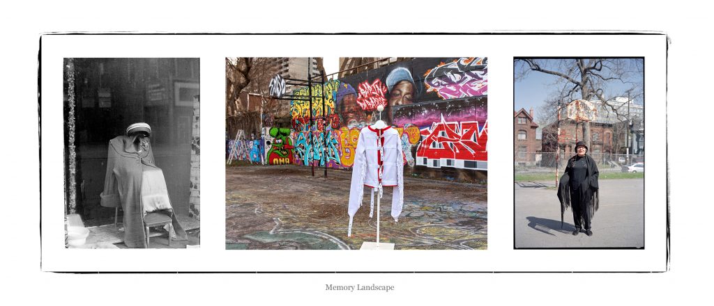
Memory Landscape
![]()
Click on anchor points to view corresponding panel and title. You can move the map around by clicking and dragging. View a larger version of the map by clicking on the [ ] brackets on the top right of the map.
![]()
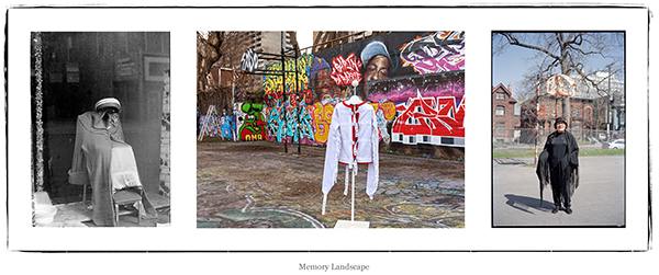
1. Memory Landscape (2016) pigment print on archival paper
KEY TO IMAGES (left to right)
Jeff Thomas, Store Front Window Display (c. 1982) Allen Street, Buffalo New York. GPS: 42.89918 -78.87084
Jeff Thomas, The Tech Wall, Slater & Bronson (2015) “This Is The Problem,” jacket by artist Tanya Harnett, Ottawa, Ontario, GPS: 45.4153413 -75.7068984
Jeff Thomas, Madeline Dion Stout, Cree, The Tech Wall, Slater & Bronson (2001) Ottawa, Ontario, GPS: 45.4153413 -75.7068984
![]()
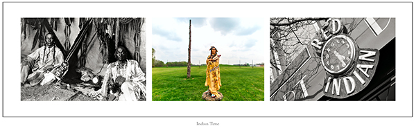
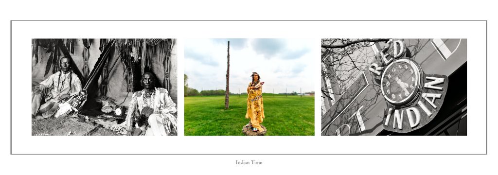
2. Indian Time, Mississippian Astronomy (2009/2016) pigment print on archival paper
KEY TO IMAGES (left to right):
Edward S. Curtis, In a Piegan Lodge, Little Plume and son Yellow Kidney (March 11, 1910) GPS: 38.88868 -77.00471, Courtesy of the Library of Congress/LC-USZ62- 051432, LC, Washington, D.C.
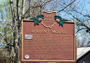
Jeff Thomas, “Woodhenge” Ancient Mississippian Solar Calendar site (2015) Collinsville, Illinois, GPS: 38.6599 -90.075133
Jeff Thomas, Red Indian Art Deco Incorporated (2003) Queen Street West, Toronto, Ontario, GPS: 43.648 -79.40005
![]()
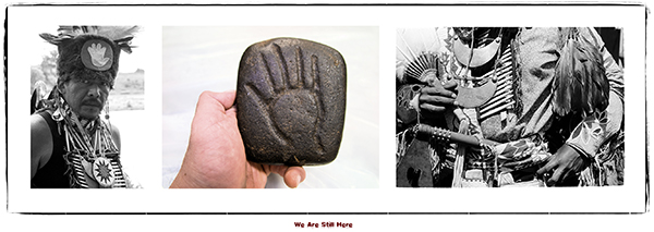
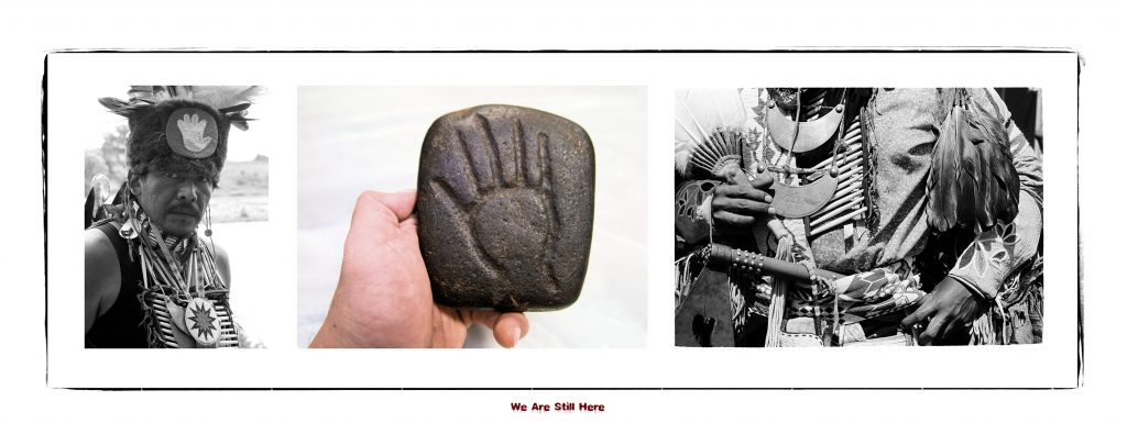
3. We Are Still Here (2015) pigment print on archival paper, 15” x 44”
TRAVELOGUE: April 18, 2015, Cahokia complex, Woodhenge, Collinsville, Illinois
I am just a short distance from Monks Mound now and posing Buffalo Robe in front of the Woodhenge circle. What came to mind while I studied the site was a previous diptych panel I made titled “Indian Time.” The first image was made by Edward S. Curtis and shows a Blackfoot father and son seated in their tipi with a clock placed between them. The second image shows an outdoor sign for an antique store in Toronto, Ontario, with a clock surrounded by the words Red Indian. But I also felt something was missing and I needed a third image.
The negative perception and stereotype that Indians were primitive and had no sense of time keeping was on my mind for a third image. In Curtis’s 20 volume publication “The North American Indian,” the clock has been removed and pipes are highlighted and noted in the author’s caption. Luckily I found a version of the Piegan Lodge with the clock on the Library of Congress web site. Now I had an image to add to the panel and complete the triptych.
KEY TO IMAGES (left to right):
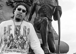
Jeff Thomas, Jerry Hawpetoss, Menominee (1984) Grand River Powwow, Ontario, GPS: 43.114367 -80.11235
Jeff Thomas, Mississippian stone tablet (2016) date: approx. 1000. Found 4 miles west Hanley, Saskatchewan, GPS: 51.62797 -106.43948 (discovered in a farmer’s field, about 1914, by Archie G. Reed, Donated by Gary Reed & Family, Wanuskewin Heritage Park, Saskatchewan)
Jeff Thomas, Jerry Hawpetoss, Menominee (1984) Grand River Powwow, Ontario, GPS: 43.114367 -80.11235
![]()
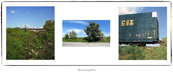
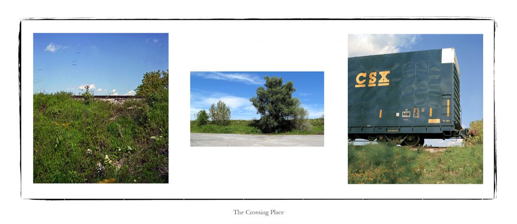
4. The Crossing Place (2005/2017) pigment print on archival paper
TRAVELOGUE: Oshawa, September 21, 2005, 11:34, parking lot of Leisure Lanes Bowling
I made an unplanned stop this morning to photograph a train idling on a bridge over Highway 401. While waiting for the train to move, I had an unexpected encounter. I was watching a flock of small birds fly towards me and I just happened to click the shutter release on my camera as they passed by. After landing in nearby small tree near me, a small hawk flew into the tree and came out with one of the birds in his talons. The hawk landed by my feet; but when I moved I frightened the hawk and it lost its grip on the bird. Both birds flew away. I also noticed a crow flying overhead, maybe waiting to steal the hawk’s meal. There was a message in this encounter and it inspired my journey to find the Birdman.
KEY TO IMAGES (left to right):
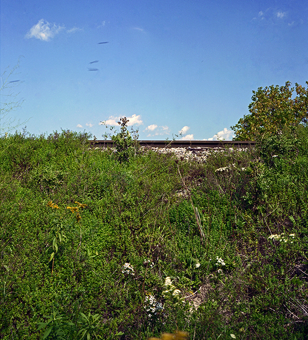
Jeff Thomas, Small Birds Chased by a Hawk (2005) Leisure Bowling Lanes, GPS: 43.87552 -78.88304
Jeff Thomas, Leisure Bowling Lanes, (2005) GPS: 43.87552 -78.88304
Jeff Thomas, CSX Boxcar (2005) Leisure Bowling Lanes, Oshawa, Ontario, GPS: 43.87552 -78.88304
![]()
View the other Portfolios from this series:
MEMORY LANDSCAPE
STRONG HEARTS: MY JOURNEY WITH BIRDMAN
REBINDING THE NORTH AMERICAN INDIAN
THE EUROPEANIZATION OF TURTLE ISLAND
![]()
![]()